
|
So you decided to build a GIS, spent money on it, you know where everything is, Now What? Everything. Everything that happens, happens somewhere. If it has a location you can track it in GIS. But if you've already mapped it, why do you need staff to tend it? The easy answer is because things change. The better answer is that a good GIS will help you answer questions, it will facilitate analysis, and makes it possible to present data in a visual format...it is only limited by your imagination. "The application of GIS is limited only by the imagination of those who use it.” ~ Jack Dangermond, Esri Here is a clip from a poster that expands the topic a bit more: 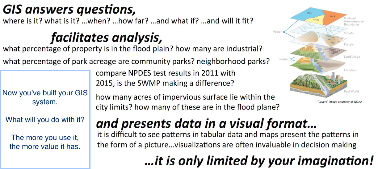 Here is more concrete example in a municipal context: Your engineering firm needs to know, what is the difference between extending a sewer line to a property from one direction vs another? They need to answer this so they can quote the cost either to you or your citizen. You can go out into the field (start your truck, drive over there) and measure the length and direction from the end of the sewer line on the east side, then measure the length and direction from the end of the line on the west side, drive back to the office and use several written sentences to describe the where with lengths and directions and pipe sizes and types, etc. OR - you can email them something like the image below which took about ten minutes to create. You didn't leave the office, start the truck, drive over there, get out the measuring tape, drive back, and you didn't describe the situation using any text (the full map has a legend, etc.). 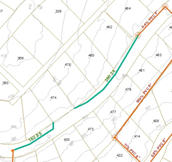 This is just one tiny example of how a municipal GIS will be used after it's built, and you'll need at least one staff member with GIS training to help you do this. So back to your question, Now What? Use your imagination because this blog space is much too small to do the answer justice. And remember...
0 Comments
Leave a Reply. |
GISCNRBringing you highlights on topics ranging from gps to GIS and back again. Blog Author:
|
 RSS Feed
