
How big is small? The words large and small are open to interpretation. However, it is my experience that there is a line between large and small where budgets and perceived need of GIS are concerned.
When administrators do not realize or acknowledge the need for GIS, it passes by unnoticed. It may even be summarily dismissed without any consideration at all. In this case, the perception is "no need, therefore no budget". Have you ever tried to convince a polar bear that he needs a freezer? Likely not, but when it comes to making the budgetary argument for funding a small town GIS, it may well turn into a polar bear/freezer comedy. For small towns, the cost is high, perceived need is nil, and budgets are restrictive. In this case, the Benefits of GIS don't play a part at all - and administrators don't want to hear about it. Generally speaking, the bigger the town the more likely that a perceived need for GIS will manifest. At some point, larger communities become faced with having simply too much data to process when infrastructure, zoning, or park details are needed, just to name a few. For larger towns, the question is not "If GIS" but rather "What flavor of GIS". Being overloaded with too much information leaves the larger towns with no choice, and with less restrictive budgets, a GIS will likely be implemented. So where is the line? From abundant research and reading through numerous case histories of municipal GIS implementation, the line is drawn near population 10,000. I say "near" because it is not a hard line. Variable events that lead small towns to successful implementation include, but are not limited to:
Every case study I read indicated that GIS goes nowhere for small towns that have no GIS Champion. This is the person, or people, who are knowledgeable, persistent, and convincing in their arguments for the need and benefits of GIS. Even with a GIS Champion the budget takes the rap in preventing GIS implementation, and coupled with a lack of perceived need, you may as well sell that freezer to the polar bear. Regardless of where the budget/population line falls, all stakeholders need to be interested in the benefits of GIS and they must be willing and able to participate in the process from end-to-end.
2 Comments
Welcome to our blog! Our End-to-End monthly blog will bring you the latest Hot Topics in gps data collection and GIS as we encounter them. Topics will vary across the spectrum from gps to maps and back again. We have a direct line to all things gps via our partners at GeoMobile Innovations and coupled with GISCNR knowledge base, we provide a full spectrum of geospatial services. Whether your interest is high-precision data collection, geodatabases, GIS training, or any stop between, you'll see it here! Our aim is to assist you in creating and using reliable, accurate spatial data to help you make the hard decisions you're faced with on a regular basis. 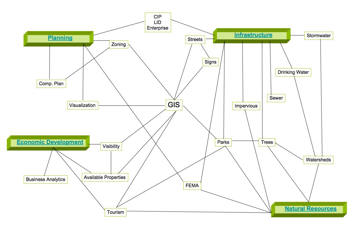 |
GISCNRBringing you highlights on topics ranging from gps to GIS and back again. Blog Author:
|
 RSS Feed
